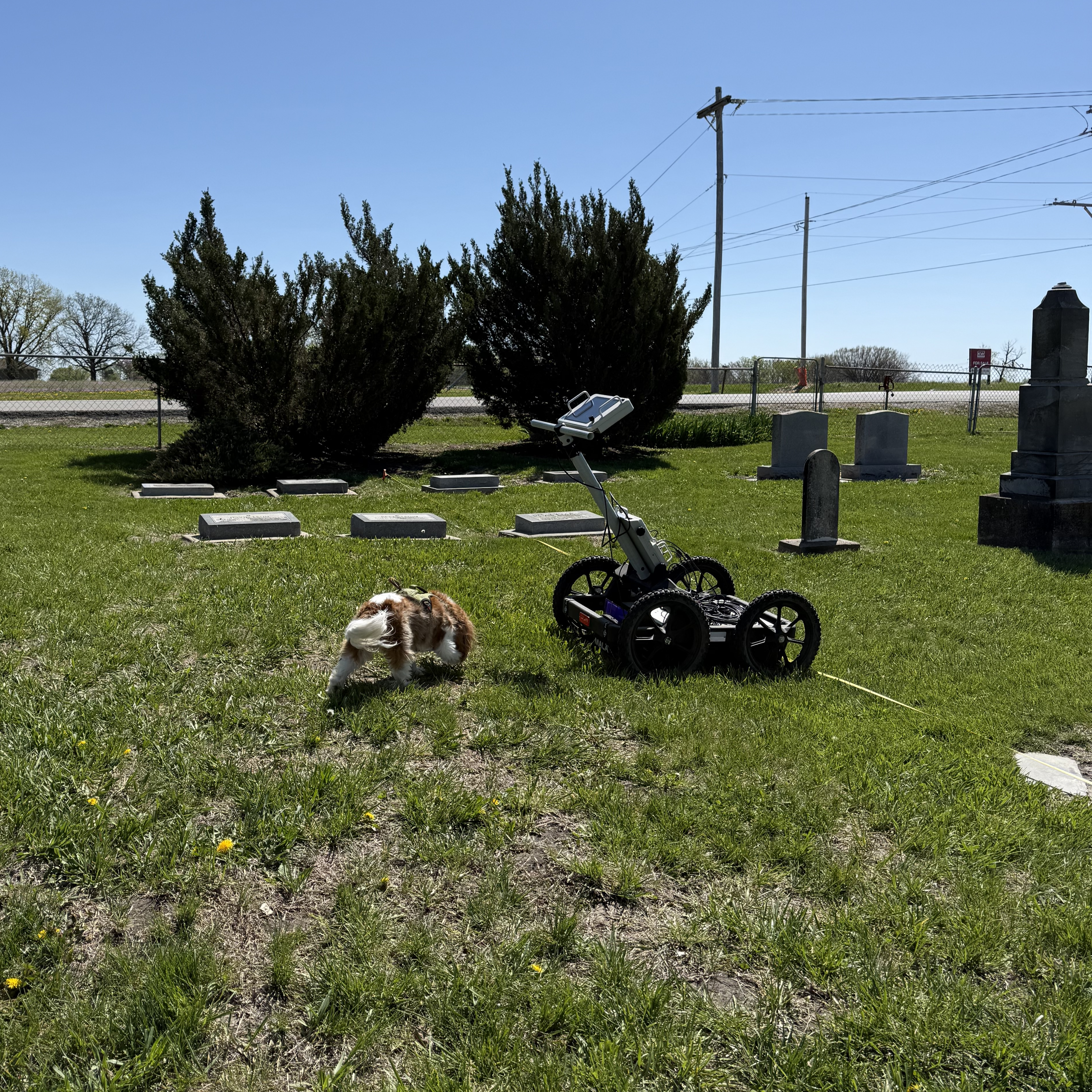
In early April, the Lawrence Jewish Community Congregation (LJCC) hired Dr. Blair Schneider of the Kansas Geological Survey and her team to collect underground data at the Beni Israel Jewish Cemetery in Eudora.
They utilized GPS, ground penetrating radar and magnetometry surveys.
This research is funded by a 2024 grant from the Douglas County Heritage Conservation Council and will fill in knowledge of the history of the cemetery, allowing the LJCC to place restored markers more accurately, locate the genizah sites (buried religious texts) and potentially find unmarked graves.
Initially, Dr. Blair’s team surveyed the historical part of Beni Israel Cemetery, spanning 910 square meters. They took GPS coordinates of all trees, headstones, benches, plot markers, genizah and grid boundaries. According to Research Assistant Ayla Alves Borges Faria, “This allows us to place all surface targets within a map to help us understand our data and to guide us as to where/what any anomalies seen in the dataset could be.”
They next conducted a magnetometry survey with 0.25-meter line spacing, which measures Earth’s magnetic field, with the help of LJCC members Caroline Caine and Azariah Betzalel. This survey helps to identify anything that contains metal or has been burned in the subsurface.
The second survey was a ground penetrating radar with 0.25-meter line spacing, which provides high-resolution imagery of subsurface features such as foundations and graves, helping to identify any potential unmarked burials. This survey was conducted over four days with the help of LJCC members Caroline Caine and Joey Seiwert.
The LJCC expects to receive results of the surveys toward the end of August. Results are dependent on the timeline after “fieldwork season” – surveys and data collection happen when the weather is nice and warm, and often the team has between four and seven sites to survey scheduled for the months of March until August.
The final report will include maps of the area, maps of subsurface activities and “clean” datasets of all surveys. It will also include a description of anomalies, with markers on all the anomalies seen and what they could represent.
In addition to the historical information about the cemetery, the LJCC will use the detailed site map to refine the cemetery plot allotment map to plan for future burials. The county funding for this project also provided for improvements at the cemetery, including regrading the road, installing new signs, levelling and repairing headstones, adding a bench and offering two fall cemetery tours.
